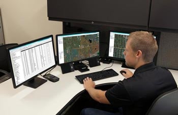
Our Geographic Information System (GIS) integration allows you to see what’s going on beneath the surface by plotting the observations and locations onto the pipe layer of any geo database.
Though software, our team can inspect a sewer from all angles, then provide detailed GIS mapping. After one of our GIS sewer inspections, you will be aware of any cracks, roots, or infiltration that could be causing problems.
Our team can link videos and pictures to the GIS database. Armed with this information, you would have access to a multidimensional analysis of your sewer collection systems. This enables us to strategize asset management and infrastructure repair.
Our cutting-edge technology and services allow us to:
- Link videos and pictures to database
- Attribute tables with NASSCO coding and scoring
- Compare original GIS data with inspection GIS export
- Convert shape files into an array of viewable GIS programs
If you are interested in how our GIS sewer inspection integration services can help your next project, feel free to contact Plummer's Environmental Inc. at (616) 877-3930. At Plummer’s Environmental Services, we are committed towards serving the waste management needs of Grand Rapids and its surrounding West Michigan areas.


